Map · 3 min read
Your campsite's interactive map: what your guest sees on your website and in the Guest App
Published
An interactive campsite map is the campsite’s plan with life on top: the guest taps a place and sees its card, with a photo and a description. With doit.camp, guests see it on the campsite website and in the Guest App, in their own language, wherever they are in Europe.
At the front desk the same question always comes up: “where is the pool?” With the doit.camp map, the answer is on the guest’s phone.
What is the doit.camp interactive map?
It is your plan, with life on top. You provide an image of the campsite and the places that matter: pool, showers, reception, restaurant, pitches. Each place has its own card: photo, title and description.
It has three parts:
- The plan: an image, yours.
- The elements: the places on the campsite, each with its card.
- The same map in two places: the campsite website and the Guest App show the same thing.
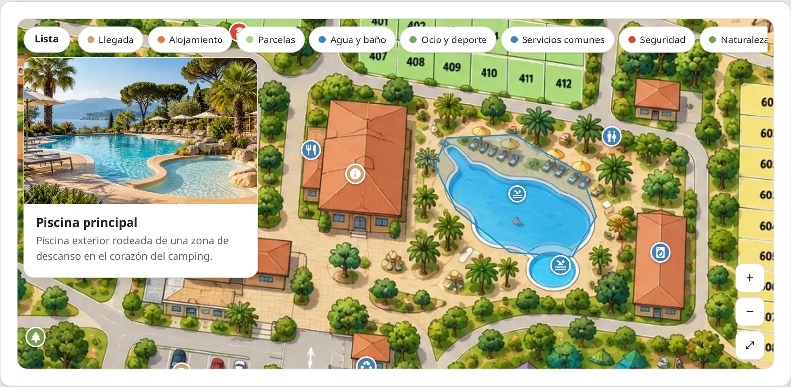
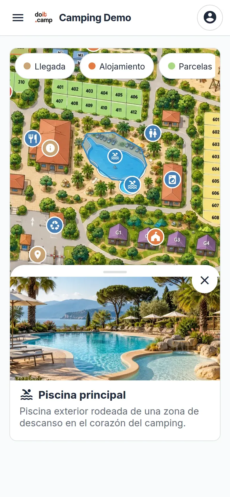
What problem does it solve?
A campsite is big and the guest does not know it. Every question ends up at reception. The interactive map takes that load off:
- The questions at the desk. “Where are the showers?”, “how do I get to the restaurant?”. The guest checks their phone.
- Night arrivals. Anyone arriving when reception is closed can find their way without waiting for anyone.
- The guest who does not speak your language. Each card is shown in theirs. No sign per language and no printed plan for each guest.
- The website that does not explain the campsite. A photo of the plan does not say what is in each place. A map with cards does, before the guest books.
The team repeats fewer explanations. The guest finds their way on their own from day one and has more time to enjoy the campsite.
How does the guest experience it?
Before arriving, the map is on the campsite website, inside a page that already exists. Someone deciding where to spend their holiday sees what the campsite is like, not just a list of services.
During the stay, they open it on their phone from the Guest App. There is nothing to install: it is a web page that opens in the browser.
In both places they do the same:
- Tap a place on the plan to open its card.
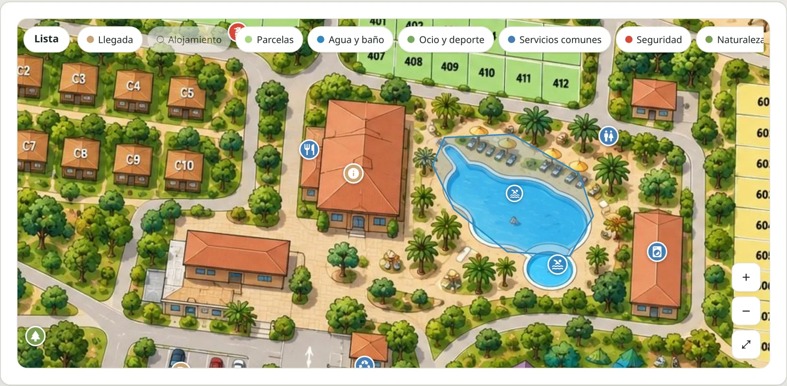
- Filter by category: water and toilets, accommodation, shared services…
- Read the card, with photo and text, in their language.
- Search the list with the «List» button, without touching the plan. It is accessible by keyboard.
What does the campsite decide?
The map belongs to the campsite. You decide:
- Which places and zones are shown, and which are not.
- Which photo, title and description each card has, in each language.
- Which categories appear as filters, so the guest does not get lost among too many.
- How many maps you have: one general map, or one per zone or per type of accommodation.
- Which type of map you use: basic, only with the plan image, or interactive, with cards and filters.
It is your plan and your way of showing the campsite. You do not need design or mapping skills: if you have an image and know what you want to show, you have the essentials.
One map for the whole team?
Yes. The same zones the guest sees also serve to link the team’s tasks. Reception, cleaning and maintenance talk about the same places, with the same names.
Who is it for?
For campsites and resorts across Europe, of any size, with guests arriving from several countries. The map is shown in Spanish, Catalan, English, French, Italian, Portuguese and Dutch.
It works inside your campsite’s current website: there is no need to rebuild it. And it is part of the Guest App for campsites from doit.camp, which brings activities, rentals, the shop, documents and payments together in one web interface.
Frequently asked questions
Do I need the Guest App to have the map?
No. You can show it only on your campsite website, only in the Guest App or in both. You choose where it appears.
Can I use my current plan?
Yes. An image is enough: the illustration or technical plan you already show at reception. The campsite's places are placed on top of that image.
Does it work on mobile?
Yes. Guests zoom with their fingers, tap a place to open its card and use a «List» button to find it without touching the plan. Nothing needs to be installed.
In which languages is the map shown?
In Spanish, Catalan, English, French, Italian, Portuguese and Dutch. Each card shows its title and description in the guest's language.
Does it have GPS?
No. It is your campsite plan, not a street map: it shows where each thing is, not the guest's position or routes.
Can I have it only on my website?
Yes. The map fits inside a page of your current website, without changing or migrating it, and it looks like your campsite.
Shall we look at your site plan?
Tell us about your campsite and we will show you the map with your own plan.
